Options

Options

Up, up and away...

Home Lat/Lon

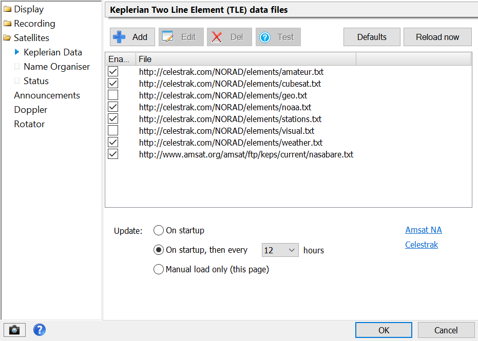
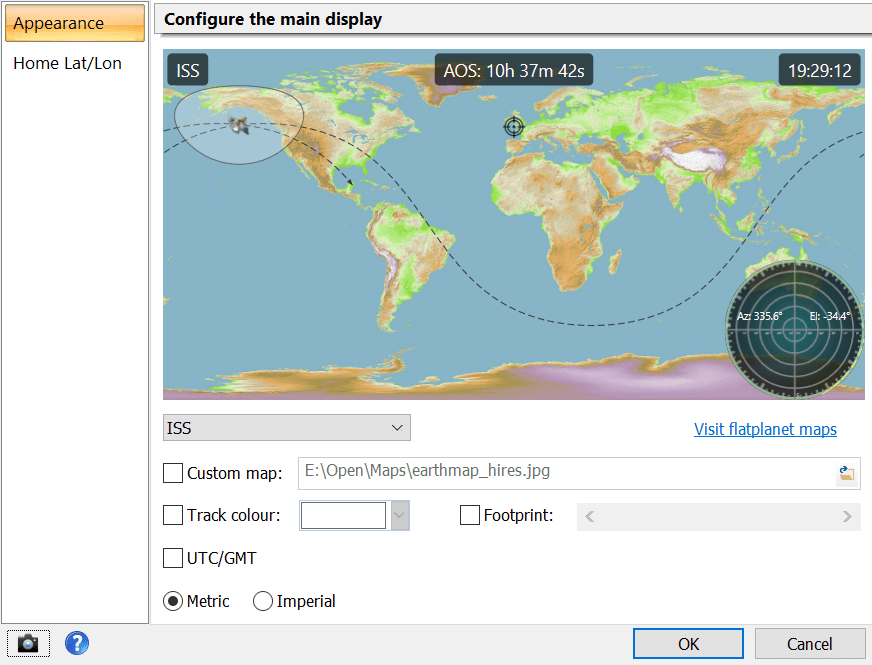
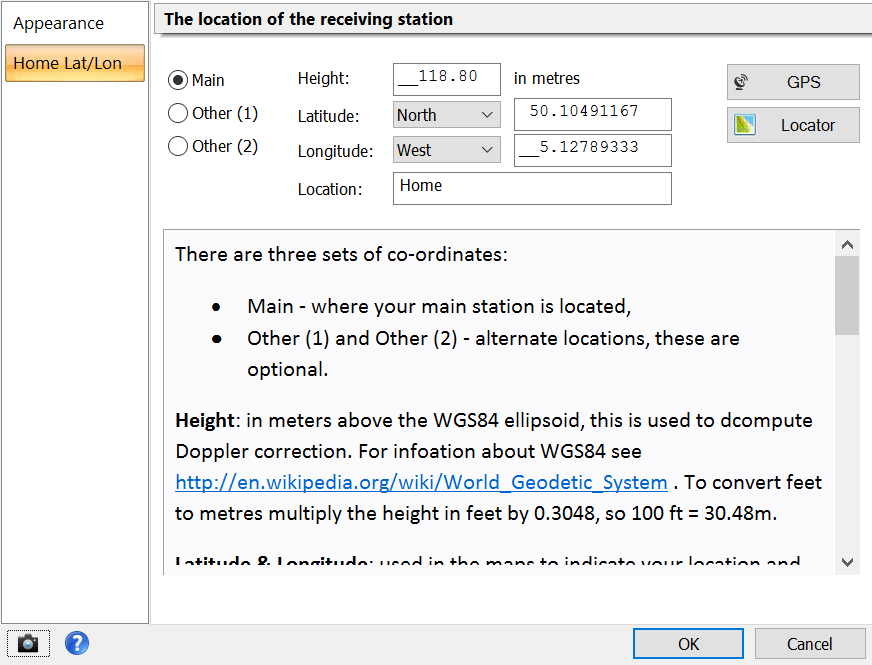
The first thing to do is enter your home (observer) latitude and longitude. Simply right-click on the main display (or select Options from the Help pane of the ribbon bar) and then select Home Lat/Lon.


There are three sets of co-ordinates:

  • Main - where your main station is located,
  • Optional: Other (1) and Other (2) - alternate locations.

Height: in meters above the WGS84 ellipsoid, this is used to compute Doppler correction. For information about WGS84 see http://en.wikipedia.org/wiki/World_Geodetic_System. To convert feet to metres multiply the height in feet by 0.3048, so 100 ft = 30.48m.


Latitude & Longitude: used in the maps to indicate your location and also used to compute Doppler correction. These values are in degrees, not degrees and minutes, so 9° 30' is entered as 9.500000 .


It is essential that you enter an exact latitude / longitude for satellite tracking to help provide the best possible Doppler correction. Height accuracy is not too important.

If you are not sure of your co-ordinates visit http://maps.google.com/ . Right-click on your location and select either the Lat/Lon Marker or What's Here option from the popup menu.


If you have a GPS unit which supports the NMEA 0183 standard then you can use this when you press the GPS button. An example of such a unit is the Navilock NL-402U USB GPS / Galileo Receiver, see http://www.navilock.de/ for more information.

Keplerian Data (TLE)

The definitions for satellites are contained in Two Line Element (TLE) data files which this program downloads for you from various internet sites:
You configure these files and how often you download them in the Keplerian Data page of the Satellite Tracking Options. Note - you should not need to change these definitions.

If a satellite is defined in two or more files then the most recent definition is used. For a description of TLE data see Wikipedia.

CelesTrak

This site offers the most complete freely available source of TLE data files. If you are looking for a specific satellite you will find it on http://celestrak.com/NORAD/elements/ - just add the file on this page which contains the data.

Main Display

If you right-click on the main window where the satellite position is shown the Appearance option window is shown.

The default map is built into the program, you can select a map from a file if so desired. Maps can be found on the flatplanet map catalogue on sourceforge. Another option is to use Google.

The only requirement is the map projection must be rectangular (see equirectangular) - the width is twice the height.

Announcements

Time, tide and satellites wait for no man. To avoid missing a pass the software optionally makes announcements:
  • 2 minutes before the start of the pass
  • 1 minute before the start of the pass
  • When the pass starts
  • At the end of the pass
Presently the announcements are in English - other languages will be supported at a later date.

Text to Speech is part of Windows 7, 8 and 10 . You configure speech recognition via the control panel.

Doppler Correction

When receiving a signal from a non-geostationary satellite you must compensation for the Doppler effect, this is the change in frequency of the signal as the satellite moves relative to the observer. Automatic Doppler correction is available:
  • Select Options from the Help pane in the ribbon bar
  • Select Doppler
  • Select 'Start of pass: on, End of pass: off'
  • Optionally add extra time so that Doppler starts before AOS and ends after LOS.
When Doppler correction is active you see the value added to the centre frequency in the main waterfall. In this example 2,035 Hz is added to the centre frequency of 137.1 MHz.

In the satellite tracking window the status bar under the map shows the same information.
Share by: